Drone Dynamics Logo
UAV, one promise for delivering
  • Home
  • Products
    • Sentinel Y6 Ultra
    • Sentinel X6 Pro
    • Sentinel X6-Plus II
    • Sentinel X4-Plus Recon
    • Eliminator 30
  • About
  • News
  • Contact
  • English
    • ✓ English
    • 中文 (台灣)
    • 日本語
  • Menu

What is GIS – GIS Explained | NorthernGIS

Posted on August 30, 2015September 29, 2015 by Drone Dynamics Press

A Geographic Information System (GIS) is a system used for capturing, storing, manipulating, querying, analyzing and displaying geographically-referenced data
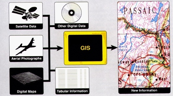
Source: What is GIS – GIS Explained | NorthernGIS

Tagged GIS.

Trademark

All brand names, logos, and trade marks belong to their respective owners.

Social Links

YouTube
Telegram
WhatsApp
© 2026 Drone Dynamics